Kings Arms Inn, Barnaby street / Bermondsey street, Southwark St John Horsleydown
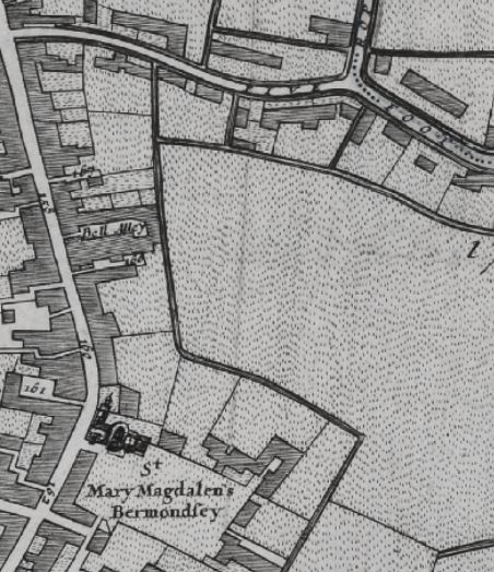
The 1682 Morgans map of London lists the '161 Kings arms Inne' which is in Barnabie street, this later becomes Bermondsey street.
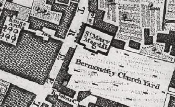
The John Rocques Map of London in 1746 listing lists the Kings Arms Inn, opposite St Mary Magdalen, and Bermondsey churchyard
A listing of historical London public houses, Taverns, Inns, Beer Houses and Hotels in Southwark St John Horsleydown, Surrey, London.
Residents at this address.
The 1682 Morgans map of London lists the '161 Kings arms Inne' which is in Barnabie street, this later becomes Bermondsey street
In 1708 : A New View of London by Edward Hatton lists Kings arms Inne on the Westerly side of Barnaby street (Southwark) near the Southerly end.
The John Rocques Map of London in 1746 listing lists the Kings Arms Inn, opposite St Mary Magdalen, and Bermondsey churchyard.